A precarious ceasefire between Israel and Hamas is teetering on the brink of collapse, as new conditions imposed by Israel threaten to derail the tentative peace. Israel has blocked humanitarian aid from entering Gaza, a move taken in retaliation to Hamas's refusal to accept a fresh Israeli proposal. The new proposal aims to extend the truce but doesn't include any commitment to end the hostilities or a complete withdrawal of troops.
This situation adds a new layer of complexity to the already tense environment in the region, as the ongoing conflict between the two parties shows no clear signs of resolution. The current stalemate stems from a disagreement over the terms of the ceasefire, specifically related to the future of the conflict and Israel's military presence in Gaza.
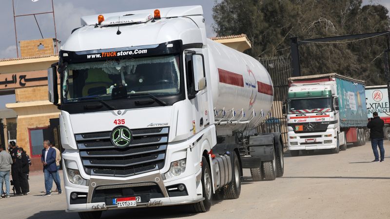
The Current State of the TruceThe fragile peace agreement between Israel and Hamas has been put in jeopardy after Israel blocked the entry of humanitarian aid into Gaza. This move, seen by many as a retaliation, came in response to Hamas' refusal to accept a new Israeli proposal to extend the ceasefire. The proposal did not come with any commitment from Israel to end the war or to fully withdraw its troops from Gaza. It is important to note that this truce has been a key element in mitigating the escalating tensions and violence in the region.
Israel's decision to block humanitarian aid into Gaza has been criticized by various international bodies. The United Nations has expressed concern over the potential humanitarian crisis that could ensue if the blockade continues. The UN has repeatedly called for an end to the blockade, emphasizing the need to allow humanitarian aid to reach those in need in Gaza. This is especially crucial given the ongoing pandemic and the already dire economic situation in Gaza.
Hamas, on the other hand, has remained defiant in the face of Israel's actions. It has rejected the proposed extension of the ceasefire, insisting that any agreement must come with a commitment from Israel to end the war and withdraw its troops. The group has also demanded the lifting of the blockade, arguing that it is critical to alleviating the suffering of the people in Gaza.
The current impasse over the ceasefire extension and the blockade of aid has underscored the fragility of the truce. The situation remains tense, with both sides appearing unwilling to back down and the prospect of a return to full-scale conflict remains a real possibility.
The Humanitarian Crisis in GazaThe cessation of humanitarian aid into Gaza exacerbates an already dire situation. Even before the recent conflict, the Gaza Strip was already grappling with a severe humanitarian crisis. The region has been under a blockade imposed by Israel and Egypt since 2007, which has severely restricted the movement of goods and people, leading to widespread poverty, unemployment, and a deteriorating infrastructure.
The United Nations has warned that the crisis is deepening, with essential services such as health care, water and sanitation services struggling to function due to the lack of funding and resources. The halt in humanitarian aid means that much needed supplies of food, medicine, and fuel are not reaching those who desperately need them.
Furthermore, the destruction caused by the recent conflict has displaced thousands of people, who are now living in overcrowded shelters with limited access to basic necessities. The United Nations estimates that over 70,000 people have been displaced due to the conflict, adding to the already significant number of internally displaced persons in the region.
The international community has called on both parties to resume the flow of aid into Gaza and to work towards a lasting solution to the crisis. However, with the ceasefire hanging by a thread and both sides setting new conditions, the prospects for a swift resolution appear bleak.
The Impact on Humanitarian EffortsThe suspension of humanitarian aid to Gaza has raised serious concerns among international organizations. The halt in the flow of essential goods into the region could potentially exacerbate an already dire situation.
According to Sara Roy, a senior research scholar at the Center for Middle Eastern Studies at Harvard University, "The blockade on essential goods may deepen an already existing humanitarian crisis in Gaza. Conditions have been deteriorating for years due to the ongoing conflict, and this latest development may have far-reaching consequences."
Roy also pointed out the potential impact on the region's healthcare system, which is already strained as a result of the war. "Gaza's healthcare infrastructure is stretched to its limits. Without sufficient medical supplies, the ability to provide adequate healthcare is significantly hindered," she explained.
In addition to the healthcare system, the blockade also affects other key sectors including education, water and sanitation, and food security. Many fear that these sectors might collapse under the weight of the increased strain, further destabilizing the region and complicating peace efforts.
Final ThoughtsAs the situation in Gaza remains tense and unpredictable, the future of the truce between Israel and Hamas is shrouded in uncertainty. Israel's new conditions, which include the blocking of humanitarian aid in response to Hamas's refusal of their ceasefire extension proposal, have only added to the precariousness of the situation.
The hope for a sustained ceasefire and a lasting resolution to the conflict seems to hang by a thread. The international community watches closely, hoping for a peaceful resolution that would end the suffering of the people in Gaza and secure a stable future for both Israel and Palestine.
The stakes are high, and the actions of both parties in the coming days will be decisive. The world waits with bated breath as the future of the truce, and indeed the broader peace process, hangs in the balance.
Business & Economy
Jamie brings a wealth of knowledge in financial markets, global trade, and economic trends. From analyzing corporate strategies to breaking down inflation and recession risks, Jamie ensures that you stay informed about how the economy impacts your daily life.